CounterTerraRisk Solutions
CTRS Spatial
CounterTerraRisk Solutions
CTRS Spatial
CounterTerraRisk Solutions combines protective security expertise with drone-enabled spatial capability. This allows clients to understand risk, inspect assets, document environments and make better decisions from clear evidence.
Security & Resilience
CTRS Spatial
Protective security, terrorism risk assessment, Martyn's Law readiness, crisis preparedness, JESIP-informed exercising, hostile vehicle mitigation advice and independent assurance for public-facing and high-consequence environments.
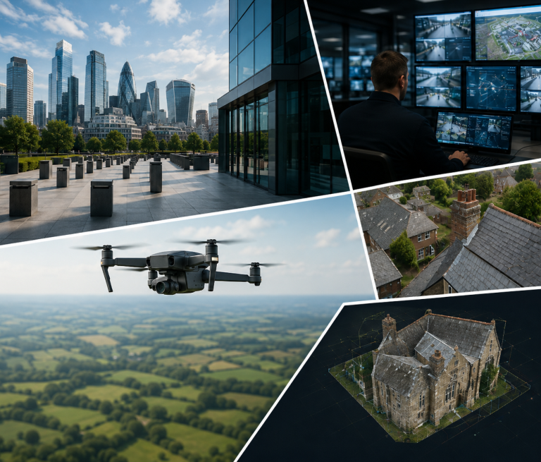
Drone-enabled inspection, surveying, mapping and digital modelling for property, estates, construction, heritage sites, infrastructure and operational environments. CTRS Spatial provides clear aerial evidence, structured imagery and usable reports without unnecessary access risk, disruption or delay.
This gives clients a safer way to inspect difficult areas, document asset condition and make decisions from clear visual evidence.
CounterTerraRisk Solutions is a UK-based advisory and operational support business helping organisations understand risk, strengthen preparedness and make defensible decisions.
Our work is delivered through two connected service lines.
Security & Resilience focuses on protective security, terrorism risk, crisis preparedness, training and assurance. CTRS Spatial provides drone-enabled inspection, survey, mapping and digital modelling services for clients who need accurate visual evidence and structured spatial data.
Together, these capabilities help clients identify vulnerabilities, inspect difficult-to-access areas, document site conditions and convert complex information into clear, practical recommendations.
We need your consent to load the translations
We use a third-party service to translate the website content that may collect data about your activity. Please review the details in the privacy policy and accept the service to view the translations.